Maha'ulepu Heritage Trail: The Complete Kauai South Shore Guide
The Maha'ulepu Heritage Trail is the best free thing to do on Kauai's south shore, and also the most consistently misdescribed. Trail guides quote three different lengths, the cave everyone photographs has been shut since 2024, and the land under your boots is private ranch country that a family stable has worked for decades. Here is what the coast actually looks like on foot, and what changes when you cover it from a saddle.
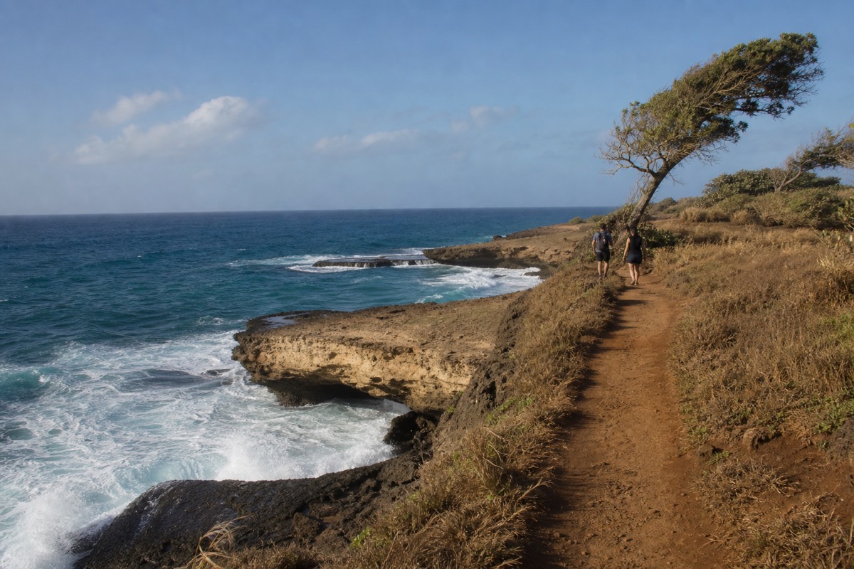
Two miles is the number most people quote for the Maha'ulepu Heritage Trail. It is also the number that sends a good share of them back to the car wondering what they missed. The trail has at least three defensible endings, the land it crosses is private, and the single best-known attraction along it has been closed to casual visitors since late 2024. None of that makes the walk less worthwhile. It just means the version of the trail in most blog posts is not the version you will find at the trailhead.
What follows is the practical guide: real distances, real parking, what you pass and in what order, the wildlife rules that actually carry legal weight, and an honest comparison of covering this coast on foot against covering it on horseback. The ranch land behind the beach is the same ground CJM Country Stables has ridden for years, which is why the trail and the Kauai horseback tours that run out of Koloa keep showing up in the same conversations.
Where each landmark falls along the trail
Distances plotted from onX Maps trail data for the point-to-point route (3.56 miles, 230 ft of climbing, 117 ft high point). The Kawailoa Bay position is derived: guides put Ha'ula Beach about three quarters of a mile past Kawailoa, which places the bay near mile 2.8. Verified August 2026.
How Long Is The Maha'ulepu Heritage Trail?
The full point-to-point route runs about 3.56 miles from the Shipwreck Beach trailhead to Ha'ula Beach, with roughly 230 feet of total climbing and a high point of only 117 feet. Most visitors walk a shorter version: two miles out to Maha'ulepu Beach and two miles back, which takes around two hours at a relaxed pace.
The confusion is easy to explain once you see it laid out. Three different turnaround points are all called "the Maha'ulepu trail" by somebody. The first is Maha'ulepu Beach, also known as Gillin's Beach, where the coastal path meets the stable road at about the two-mile mark. The second is Kawailoa Bay, a bit further east. The third is Ha'ula Beach, the true end of the mapped route, reached by continuing roughly three quarters of a mile past Kawailoa along the most dramatic limestone of the whole coast.
Nothing about the walking is technical. The grade never becomes a climb in any meaningful sense, though onX records a maximum pitch of 35 percent on one short rise, which is enough to notice in loose footing. The difficulty comes from exposure rather than effort: there is almost no shade after the first quarter mile, the surface alternates between packed dirt, deep sand and bare limestone shelf, and several sections run close to the lip of cliffs that are undercut from below.
| Version of the walk | One-way distance | Round trip | Typical time | Who it suits |
|---|---|---|---|---|
| Trailhead to the Makawehi bluff overlook | About 0.4 mi | About 0.8 mi | 30 to 45 min | Families with small children, anyone short on time |
| Trailhead to Maha'ulepu (Gillin's) Beach | 2.0 mi | 4.0 mi | About 2 hours | The standard visit, and the one most guides describe |
| Trailhead to Kawailoa Bay | About 2.8 mi | About 5.6 mi | 2.5 to 3 hours | Walkers who want the quiet end of the beaches |
| Full point-to-point to Ha'ula Beach | 3.56 mi | About 7 mi | 3.5 to 4.5 hours | Confident hikers carrying real water, starting early |
Trail data for the point-to-point figures comes from the onX Maps record for the route, which lists 3.56 miles, 230 feet of gain, 223 feet of loss and a low point of seven feet above sea level. If you plan on the four-mile round trip and then feel good at the beach, the extra ground east is there for the taking. Plan for the full seven and you will want an early start, because there is nowhere to refill water and nowhere to hide from the sun.
Where Does The Trail Start, And Where Do You Park?
The main trailhead is the small public lot beside Shipwreck Beach at Keoneloa Bay, reached off Ainako Road at the eastern end of Poipu Road next to the Grand Hyatt. The lot holds roughly fifteen cars with a small overflow area uphill, it is free, and on a busy morning it fills before nine.
Park, walk to the sand, and turn left toward the tall bluff. The path climbs the shoulder of that headland within a few minutes and the ocean opens up almost immediately. There is no ticket booth, no ranger station and no sign-in sheet, which surprises people who expect a state park experience. Signage along the route is thin and gets thinner the further east you go.
Get there before 8:30am on any day you are not willing to circle. The Shipwreck lot is genuinely small, it serves surfers and beachgoers as well as walkers, and the resort parking next door is not an overflow option. An early start also solves the shade problem, the wind problem and the crowd problem in one move.
There is a second, quieter approach from the far end. Vehicles can reach the Maha'ulepu Beach side by an inland dirt road that Grove Farm controls, with a gate that has historically been opened in the morning and shut in the evening. Public reporting since 2020 has repeatedly described that gate as closed to general visitor traffic, and conditions have changed more than once. Do not build a day around driving in. If you want to see the eastern beaches and you are not up for the full coastal walk, the honest answer is that the horseback route from the stables covers that ground without the parking lottery.
Is The Maha'ulepu Heritage Trail Free, And Who Owns The Land?
Walking the trail costs nothing and needs no permit or reservation. The route crosses private land, most of it belonging to Grove Farm, with public foot access maintained by long-standing custom and by the volunteers of the Malama Mahaulepu group. The stretch behind the beaches is working ranch and stable country, not park land.
That distinction matters more here than it does on most Hawaii hikes. Fenced sections are leased and in active use. The dunes above the beaches are burial grounds and are treated as sacred by Native Hawaiian families, a point the stewardship group states plainly in its visitor map and tips. Staying on the established path is not a suggestion about erosion. It is the condition on which the access rests.
The same page warns that the limestone headlands are undercut and hazardous, which is easy to underestimate when the rock looks solid underfoot. Sections of the bluff overhang open water. People do jump from parts of these cliffs, and people are also injured doing it. There are no lifeguards anywhere along this coastline.
Land use here has been continuous for well over a century. The Maha'ulepu district ran sugar during the plantation era, shifted toward cattle ranching as the mills wound down, and now carries a mix of pasture, conservation projects and small-scale tourism. The red iron-rich soil you will get on your shoes is the visible leftover of all of it.
What Do You Actually See Along The Trail?
In order from the trailhead: the Makawehi lithified cliffs, formed from sand dunes that hardened roughly 125,000 years ago, then the Waiopili Heiau site, a stretch beside the Poipu Bay Golf Course, Punahoa Point, the wide sweep of Maha'ulepu and Gillin's Beach, then Kawailoa Bay and finally the blowholes and trenches before Ha'ula Beach.
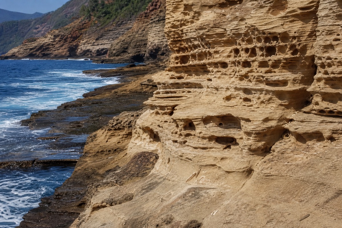
The lithified dunes are the geological headline and the reason the coast looks nothing like the rest of Kauai. Wind-blown sand piled into dunes, calcium carbonate cemented the grains together, and the sea has been carving the result ever since. What is left reads like fossilised weather: crossbedded layers, honeycombed pockets, sharp fluted edges where salt spray has eaten into the rock. Ironshore surfaces like this are hard on soft footwear.
Past the golf course the path loosens into the more interesting half. Ironwood trees give the only real shade on the route. The beaches appear one after another, each smaller and emptier than the last. Between Kawailoa Bay and Ha'ula, the coast produces wet and dry blowholes and deep trenches that throw spray in a hard swell, which is the single most photographed section by people who walk the whole thing.
| Landmark | Roughly where | Why stop |
|---|---|---|
| Shipwreck Beach, Keoneloa Bay | Mile 0 | Trailhead, restrooms nearby, the last easy water stop |
| Makawehi bluff and lithified cliffs | First half mile | The dune-rock formations, the highest coastal viewpoint on the walk |
| Waiopili Heiau area | Early section | A Hawaiian temple site; observe from the path, do not enter or move stones |
| Poipu Bay Golf Course edge | Around the first mile | The groomed, easy-going stretch; watch for play on your left |
| Punahoa Point | Before the beach | Open ocean views, a common whale-spotting perch in winter |
| Maha'ulepu Beach and Gillin's Beach | About mile 2 | The standard turnaround, wide sand, the stable road meets the coast here |
| Kawailoa Bay | About mile 2.8 | Quieter cove, limited parking on the inland side, fewer people |
| Blowholes and sea trenches | Mile 2.8 to 3.5 | The most dramatic limestone on the coast; stay well back from the edges |
| Ha'ula Beach | Mile 3.56 | The end of the mapped route, and usually empty |
What Happened To Makauwahi Cave?
Makauwahi Cave Reserve, the collapsed limestone sinkhole near Maha'ulepu that draws so many trail photos, closed to the public on 31 October 2024 after twenty years of open access, when the founders' lease with the landowner ended. Access since then has been arranged by appointment for educational, scientific and cultural visits rather than for walk-up tourists.
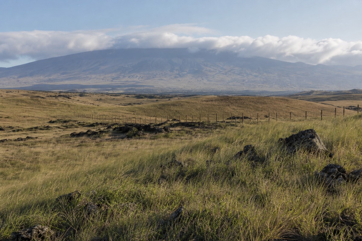
This is the single biggest gap between what the trail guides say and what you will find on the ground. The 17-acre reserve was assembled and run for two decades by researchers David and Lida Pigott Burney, whose excavation of the sinkhole produced one of the richest paleoecological records in the Pacific: layers of pollen, bird bone and sediment reaching back thousands of years, documenting what Kauai looked like before human arrival. Grove Farm declined to renew the lease, the site went dark, and public reaction was loud enough that the landowner committed to reopening once new staff were trained and stewardship arrangements were settled with a nonprofit.
Reopening has been described as a matter of staffing rather than of principle, but general walk-in access had not been restored as of this writing. Check current status before you set aside time for it, and treat the cave as a possible bonus rather than a fixed item on your route. The trail itself is entirely unaffected.
What Wildlife Will You See, And What Are The Rules?
Hawaiian monk seals haul out on the beaches along this coast, green sea turtles feed offshore, and humpback whales pass close in from November through April with a peak from January to March. Federal guidance asks visitors to stay at least 50 feet from a resting monk seal and 150 feet from a mother with a pup.
Monk seals are endangered and the population is small enough that individual animals are known and tracked. NOAA's rule-of-thumb guidance for viewing monk seals offers a field test that works better than pacing out distances on sand: hold your arm out, raise your thumb, and if your thumb covers the whole animal you are far enough away. The Malama Mahaulepu group asks for a full 100 feet in this area, which is the sensible margin on a narrow beach. Disturbing a seal can be a violation of federal or state law even though no fixed distance is written into statute, and sightings, injuries or harassment can be reported to the NOAA marine wildlife hotline on 888-256-9840.
Whale season turns the walk into something else entirely. Roughly half the north Pacific humpback population winters in Hawaiian waters, and the Hawaiian Islands Humpback Whale National Marine Sanctuary runs its volunteer Ocean Count on the last Saturday of January, February and March, at the height of the season. Punahoa Point and the high ground on the Makawehi bluff both work as vantage points. Bring the binoculars you were not planning to bring.
Seabirds nest in the cliff faces and along the dune scrub, and the ground here has been the focus of restoration work aimed at native plants. Dogs, drones and anything that would push a seal off a beach are all bad ideas for the same underlying reason.
What Should You Bring For The Maha'ulepu Heritage Trail?
Water, sun cover, and shoes with a real sole are the three that matter. There is no water on the route, no shade after the first stretch, and long sections of sharp limestone that will chew through thin trainers and end a walk in flip-flops within twenty minutes.
Everything else is refinement. The trade winds blow across this coast most days, which is a mercy on the climb and a problem for hats and lens cloths. Rain arrives fast and leaves fast on the south shore, and the red dirt becomes slick and staining when it does.
| Item | Why it matters here | Skip it? |
|---|---|---|
| 2 litres of water per person | Nowhere to refill; the exposure does the damage, not the distance | No |
| Closed shoes with grip | Sharp ironshore limestone, loose sand, one 35 percent pitch | No |
| Hat and reef-safe sunscreen | Almost no shade beyond the first ironwood stand | No |
| Wind-tolerant sun shirt | Better than reapplying sunscreen for three hours in trade winds | Optional but sensible |
| Binoculars | Whales November to April, seals resting far down the sand | Seasonal |
| Offline map on your phone | Signage thins out past the golf course and the route braids | Recommended |
| Small trash bag | No bins on the route and this is private land under stewardship | No |
| Swimsuit | Beaches are unguarded and current-prone; wading is the realistic use | Your call |
When Is The Best Time To Walk It?
Early morning, in almost any month. The south shore is the dry side of Kauai, taking 30 to 40 inches of rain a year against about 85 inches on the north shore, so conditions here are reliable year-round. Winter adds whales, summer adds heat, and the hour you start matters more than the season you visit.
Kauai's rainfall map is the most extreme thing about its weather. Mount Waialeale in the island's centre absorbs something on the order of 450 inches a year and ranks among the wettest places on earth, while Poipu and Maha'ulepu sit in its rain shadow with a climate closer to a dry coast. A wet morning in Princeville frequently has no bearing on what the south shore is doing, which is the single most useful piece of Kauai planning knowledge there is. The same asymmetry drives which side of the island stables operate on, something covered in more depth in our look at how Kauai's riding stables compare.
| Season | Trail conditions | What is different |
|---|---|---|
| December to March | Firm, occasional passing showers, strong swell | Peak humpback season; blowholes are at their most active |
| April to May | Reliably dry, moderate crowds | Late whale sightings, comfortable temperatures, easier parking |
| June to August | Dry and hot, hard sun by mid-morning | Busiest lot; start by 7:30am or accept the heat |
| September to November | Warm, calmest ocean, lightest foot traffic | The quietest walking of the year on the eastern beaches |
Should You Hike The Coast Or Ride It?
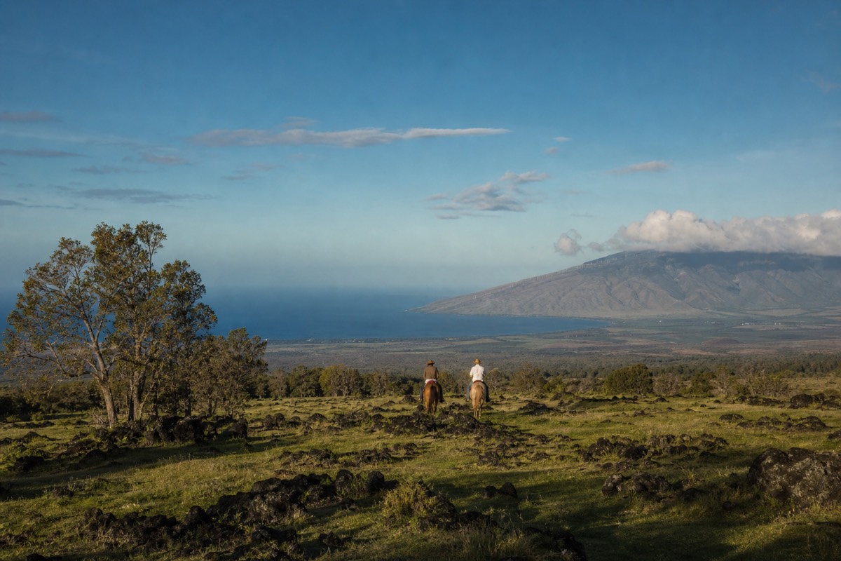
They are not the same experience on the same ground. The footpath hugs the cliff edge and the tide line, giving close detail, tide pools and the blowholes. The horseback route works the inland side, climbing through pasture and valley country to vantage points the coastal path never reaches, then turning back toward the ocean.
Walkers get intimacy. You can stop at every pocket of honeycombed rock, follow the sand as far east as your water lasts, and put your hands on 125,000-year-old dune stone. Nothing replaces that, and the trail is free.
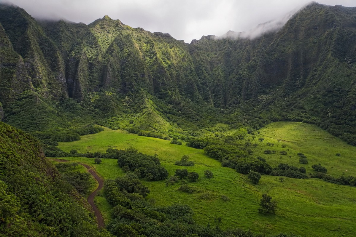
Riders get reach and altitude. The two-hour Maha'ulepu ocean, mountain and valley ride crosses working ranch land above the coastline, which is exactly the ground the public footpath does not go anywhere near. From horseback you see the shape of the district: the valley cut, the pasture stepping down toward the dunes, the whole run of the coast in one view rather than one headland at a time. You also cover ground faster than you can walk it in sand, which is the practical difference on a hot afternoon.
| Factor | Hiking the Heritage Trail | Riding the ranch route |
|---|---|---|
| Cost | Free, no permit | Paid tour; check the current listing for rates |
| Time commitment | 1 to 4.5 hours depending on turnaround | About 2 hours in the saddle plus check-in |
| Ground covered | Cliff edge, beaches, tide line | Pasture, valley, ranch high ground, coastal outlook |
| Physical demand | Sustained walking in sand and sun | Sitting a walking horse; no riding experience needed |
| Best for | Photographers, geology, self-paced exploring | Views, families, anyone who does not want a sun-exposed slog |
| Weather sensitivity | Walk it anyway; just slower and muddier | Stables can reschedule in heavy weather |
| Wildlife odds | Very good for seals and turtles at the tide line | Better for the long ocean scan; whales in winter |
Rain policy is the one thing worth checking in advance if you are booking a ride around a fixed vacation window, and we cover how that plays out in practice in our note on what happens when it rains on a booked Kauai ride.
What The Saddle Adds That The Footpath Cannot
Elevation, access and pace. The horseback route climbs into ranch country closed to the public, holds a view over the whole Maha'ulepu district rather than one bay at a time, and covers in two hours a spread of terrain that would take a walker most of a day and a permission slip.
There is also the matter of who is with you. Stable guides on this coast are working paniolo as much as tour staff, and the running commentary tends toward what the land does rather than what the brochure says: which valley floods, where the cattle move in summer, which stretch of dune was cane a lifetime ago. That is the part visitors remember, and it does not exist on a self-guided walk.
Riders with less time or smaller appetites for saddle hours have a shorter option in the one-hour sunlit shores and scenic trails ride, which trades the longer ranch loop for rolling pasture and coastal views. A third route, the scenic Kauai trail adventure, runs around ninety minutes. All three sit side by side on the shortlist of best-selling rides if you want to compare durations before committing.
Can You Do Both In One Day?
Yes, and it is the best use of a south shore day. Walk the coast at first light while the air is cool and the lot is empty, be back at the car by mid-morning, then take an afternoon or late-day ride that covers the inland half of the same district. The two halves genuinely complement each other.
A workable shape for the day looks like this. Leave Poipu around seven, walk out to Maha'ulepu Beach and back on the four-mile version, and you are done before the heat sets in with plenty of daylight left. Eat in Koloa. Ride in the afternoon, when the light on the coastline is warmer and the wind has usually settled into something steady rather than gusting.
Riders staying on the north shore have a longer drive to the south stables, which raises the same question every Kauai visitor eventually asks about where to base themselves. That trade-off, and how the island compares with Oahu, Maui and the Big Island for riding generally, is covered in our guide to which Hawaiian island suits horseback riders best.
The Short Version
The Maha'ulepu Heritage Trail is free, easy in the technical sense, unshaded, and considerably longer than most descriptions admit if you follow it to its real end. Park early at Shipwreck Beach. Carry more water than feels necessary. Stay on the path, stay back from the undercut edges, give the seals their fifty feet, and do not build the day around the cave until access is confirmed.
Then decide whether you want the coast at walking pace or the district from above. Both are the same landscape. Only one of them shows you the valleys behind it.